Salt marshes soak up carbon. Restoring them is key to fighting climate change
Susan Adamowicz, salt marsh ecosystem scientist with the US Fish and Wildlife Service, stationed at the Rachel Carson National Wildlife Refuge in Wells, Maine. (Rebecca Conley)
Marshes have been called the “kidneys of the landscape” because they clean pollutants from water. They also protect communities against storm surges and erosion, and are better than forests at capturing carbon, so are considered critical in the fight against climate change. But when they’re under stress, they degrade, and actually release carbon into the atmosphere. Scientists in Maine recently unlocked a mystery that helps explain what’s happening to marshes —and how to restore them.
This story is part of Maine Public’s series “Climate Driven: A deep dive into Maine’s response, one county at a time.“
Even though the Rachel Carson Wildlife Refuge is tucked into one of the most populated counties in Maine, it’s still possible to get lost. Especially when you’re looking for a salt marsh only accessible through dense forest.
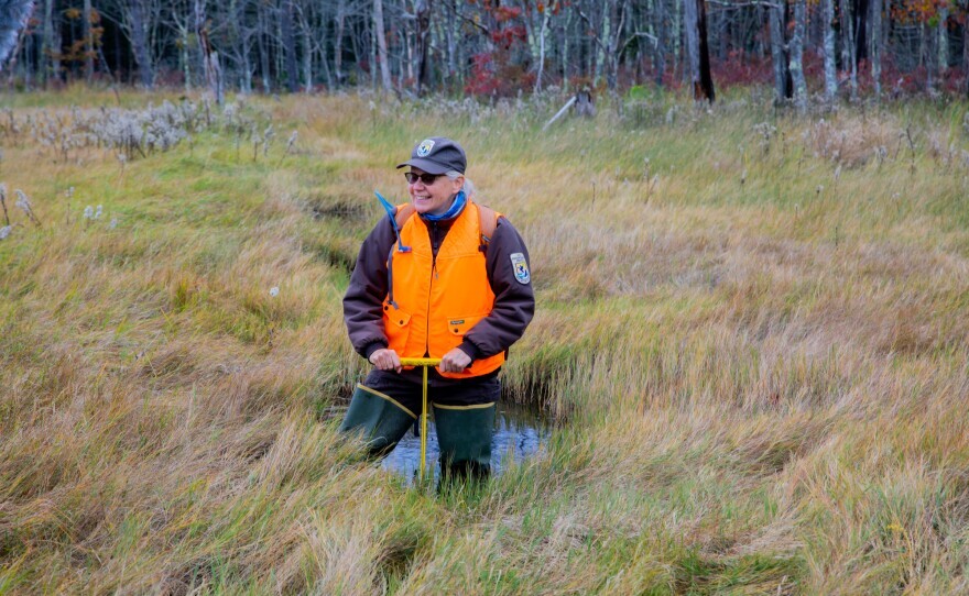
“Well, I think we’re going to have to bushwhack,” says Susan Adamowicz as she begins the journey to the marsh.
Refuge scientist Susan Adamowicz is a salt marsh scientist, but she considers herself a planet doctor. And on this day, she’s checking one of her patients: a salt marsh that’s among the 3,000 acres of marsh that are protected at Rachel Carson . The entire refuge is more than 9,000 acres. As Adamowicz works her way through the woods, stepping over tree stumps and bending to avoid branches, she’s joined by Geoff Wilson. He’s manager of the Bear Creek Wildlife Sanctuary in Massachusetts, which also does work restoring sensitive ecosystems. Eventually, the ground changes. It’s more wet. Adamowicz advises to step carefully to avoid sinking into a hole.
“Now that we’re moving into a marsh, the plants are going to be senesced, or gone to sleep for the winter, so just step on a plant rather than mud or a watery location,” she directs.
The forest opens to a 200 acre marsh blanketed with tall grass in shades of gold, rust, and green.
“The salt marshes are my Serengeti. They are wild places that bring all kinds of animals and plants there. They’re austere. They’re dramatic,” Adamowicz says.
They’re also in trouble. As we continue walking into the marsh, Adamowicz gives a clue as to why.
“You might have noticed you went up in elevation a little bit, your footing is more firm. So we believe this is probably the location of one of the first embankments that the farmers placed,” she says.
As far back as the 1600s, farmers piled soil in marshes to make embankments. They blocked out the tides so they had more freshwater to grow crops. Marsh scientists along the east coast walked over these embankments for years without realizing what they were. Many have grown smaller over time and blend in with the landscape. Larger ones were considered anomalies. But about a decade ago, Adamowicz and Wilson noticed an unnatural pattern of embankments in a marsh in Cape Elizabeth. They turned to old agricultural journals for clues and found the blueprints for these embankment systems. As Geoff Wilson walks through the marsh, he points out one after another.
“[Embankments are] everywhere. They’re more common than stone walls. That’s something that really took us by surprise,” Wilson says.
There are so many they make a grid pattern in the marsh, and it’s disrupting the natural flow of water in and out.
“They’re like multiple small dimples of a golf ball that are filling up with water at a greater frequency than used to. And then they hold that water, and that’s making it difficult for the plants to survive,” Wilson says.